Χάρτης Topspot N202 Περιοχή Tampa Bay για ψάρεμα και αναψυχή Χάρτης Port Rickey προς Βενετία

Brand:Topspot

3.7/5

65.73

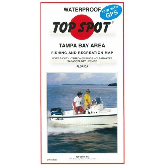
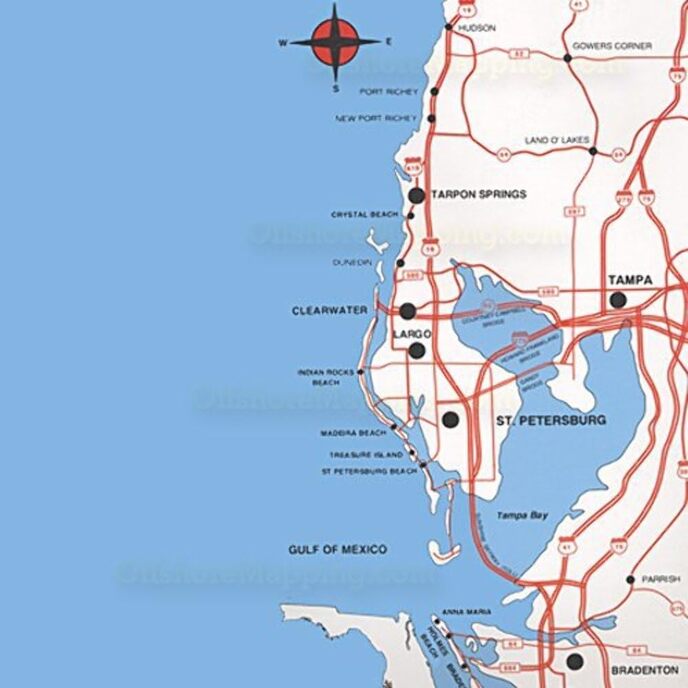
Ο χάρτης Top Spot Map N202 Tampa Bay Area Fishing Map είναι ιδανικός για τους τυπικούς αθλητές σε εξωτερικούς χώρους και διαθέτει μερικές από τις κορυφαίες τοποθεσίες για ψάρεμα στη Φλόριντα, όπως το Port Rickey, το Tarpon Springs, το Clearwater Sarasota Bay και τη Βενετία. Αυτός ο χάρτης είναι αδιάβροχος και ανθεκτικός στο σκίσιμο. Περιλαμβάνει συντεταγμένες GPS για ζεστές τοποθεσίες ψαρέματος, ράμπες σκαφών, μαρίνες και άλλα σημεία ενδιαφέροντος. Υποδεικνύει τους τύπους ψαριών θαλασσινού νερού που αλιεύονται, τους καλύτερους μήνες αλιείας του έτους και την υποβρύχια δομή.

Υποδεικνύει τους τύπους ψαριών θαλασσινού νερού που αλιεύονται, τους καλύτερους μήνες αλιείας του έτους και την υποβρύχια δομή. Περιλαμβάνει συντεταγμένες GPS για ζεστές τοποθεσίες ψαρέματος, ράμπες σκαφών, μαρίνες και άλλα σημεία ενδιαφέροντος. Αδιάβροχο και ανθεκτικό στο σκίσιμο. Διαθέτει μερικές από τις κορυφαίες τοποθεσίες για ψάρεμα στη Φλόριντα, όπως το Port Rickey, το Tarpon Springs, το Clearwater Sarasota Bay και τη Βενετία.
Brand Name ‎Topspot
Customer Reviews 4.7 4.7 out of 5 stars 116 ratings 4.7 out of 5 stars
Item Dimensions LxWxH ‎6 x 10 x 3 inches
Item Package Dimensions L x W x H ‎12 x 5.1 x 3.6 inches
Item Weight ‎1.4 Pounds
Manufacturer ‎Top Spot
Package Weight ‎1.4 Pounds
Part Number ‎N202

3.7

8 Review
5 Star
80
4 Star
11
3 Star
6
2 Star
1
1 Star
1

Γράψτε την κριτική σας

Το email σας δεν θα δημοσιευτεί. Όλα τα υποχρεωτικά πεδία επισημαίνονται με*

Scritto da: TDE
These sorta maps are really handy and durable they show you stuff you can't get from your GPS
Heading over to the west coast with my boat and wanted to get the layout of the waters before heading out. I have several of these maps for various areas in Florida and they are very informative with all the information.i like the hot tip fishing spots along with the deapth of the water before going out
Scritto da: Amazon Customer
Very useful!
Tons of info. A little hard to read but worth it!
Scritto da: John Hansen
Must have for boaters
Great for planning trips out, finding reefs and channels, and places to launch kayaks from. The waterproofing has held up to seaspray quite well.
Scritto da: Cindy O.
Valuable Information
Bought as a gift for my son who lives in Tampa. He loves it!
Scritto da: Mr. Boykin
This map was very helpful for sailing my catamaran in ...
This map was very helpful for sailing my catamaran in unfamiliar waters while camping at fort Desoto. I found It to have all NOAA info, plus LOTS of extra navigation info, and most bridge heights. Waterproof, and cheaper than a NOAA chart.
Scritto da: Thomas Lincoln
Otherwise good detail an durability
It would have a 5 star for me if the Lat/Lon grids were printed on the edge of the chart. Otherwise good detail an durability.
Scritto da: Chris and Trish
Detailed and durable!
Great map. Shows a lot of detail! Impressed.
Scritto da: Don R. Robertson
Very good item
Seems too be what I needed. Thank you.

Σχετικά προϊόντα

hot
Χάρτης Topspot N214 Jupiter-Stuart
3.9/5

€ 55.07

Χάρτης Topspot N214 Jupiter-Stuart
3.9/5

€ 55.07

hot
Topspot Fishing Map for Homosassa Area
3.7/5

€ 58.64

Topspot Fishing Map for Homosassa Area
3.7/5

€ 58.64

Ανακαλύψτε το διεθνές μας δίκτυο

Στέλνουμε σε 28 χώρες, πάνω από 200.000 προϊόντα. Μείνετε ενημερωμένοι, εγγραφείτε στο ενημερωτικό δελτίο.

Array